Chevey Hill Forest
     | |
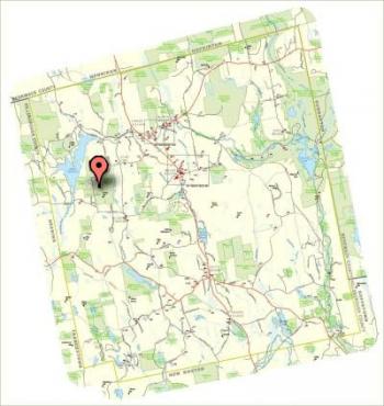
Chevey Hill ForestGPS Coordinates: 43° 5' 49.09" N, 71° 46 15.49" W Acres: 154 | 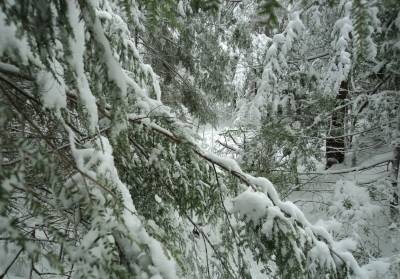 |
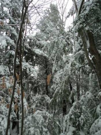
Chevey Hill ForestChevey Hill Forest includes two parcels: a northern parcel referred to as the Oliphant parcel (Tax Map 404 – 130.1) and a southern parcel referred to as the Chevey Hill parcel (Tax Map 404 – 127). For the Oliphant parcel, part of the western boundary is clearly defined by a stone wall that abuts the SPNHF Toll conservation easement property. The western boundary continues north around an excluded housing area, defined by a series of iron rods. The northwestern boundary is clearly defined by Tiffany Hill Road. Part of the eastern boundary is clearly defined by New Road (a class VI road). The eastern boundary continues north, defined by a series of iron rods and pipes until it runs into Tiffany Hill Road. The southern boundary, between the Oliphant parcel and Chevey Hill parcel, is defined by a stone wall that runs east west. For the Chevey Hill parcel, the western boundary is clearly defined by a stone wall that abuts the SPNHF Toll conservation easement property. The northern boundary, between the Oliphant parcel and Chevey Hill parcel, is defined by a stone wall that runs east west, which continues along this boundary until it intersects New Road. The eastern boundary is clearly defined by New Road. The southern boundary abuts two housing lots and a farm, which is defined with blue flagging and tree hatches painted yellow. The southern boundary also abuts a dead end cul de sac known as Chevey Hill Road. As stated above, Chevey Hill Forest includes two parcels: a northern parcel referred to as the Oliphant parcel (Tax Map 404 – 130.1) and a southern parcel referred to as the Chevy Hill parcel (Tax Map 404 – 127). The Chevey Hill parcel was an unfinished subdivision that was acquired by the Town of Weare in 1989. The Town merged the subdivision parcels into one parcel in 2007. The Oliphant parcel was purchased by the Town from the Oliphant family in 2007. Chevey Hill Forest includes the majority of the eastern portion of a hill that rises approximately 400 feet to the height of 1,180 feet. The sloped terrain is almost entirely forested featuring a mix of hardwoods and softwoods, including white pine, white birch, beech, white ash, hemlock, white and red oak, and sugar maple. Strong hemlock communities are found along the north side of the hill and along the stream and wetland complex located on the east side of the property along New Road (a class VI road). There are several drainage areas and intermittent streams that flow off the hillside and drain into the stream and wetland complex along New Road. A small portion of the wetlands lie within the northeast corner of the property. There is evidence of beaver, turkey, white tailed deer, porcupine, and pileated woodpecker throughout Chevey Hill Forest. If you have questions concerning this town forest, or if you would like materials on protecting your family land, please contact the Weare Conservation Commission through the Town Office at (603) 529-7575 or email conservation@weare.nh.gov. |
|