
Ferrin Pond Conservation Area
   < <  | |
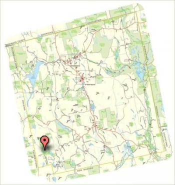
Ferrin Pond Conservation AreaGPS Coordinates: 43° 2 08.14 N 71° 46 03.40 W Permitted Uses: Town managed forestry and agriculture. Public hiking, hunting and fishing. | 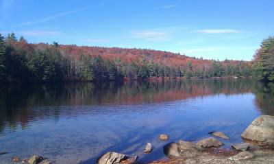 |
GPS Coordinates: 43° 2 08.14 N 71° 46 03.40 W
Ferrin Pond Conservation AreaHistory, Adopted from PLC Ferrin Pond Conservation Area Trail Guide |
|
HistoryA great force of glacial ice created Ferrin Pond during the Pleistocene Epoch. This time period spans the last million years, but only within the last 10,000 - 15,000 years did the last ice sheet disappear from this part of the world. Results of the gouging and flooding forces from moving mountains of ice (over a mile thick in much of the area) can still be seen in many places. During the Pleistocene Epoch, four glacial stages occurred. The last event, called the Wisconsin glacial stage, created Ferrin pond. Ferrin Pond was named after Enos Ferrin, who lived in the area during the mid to late 1700's. Local records show he served in the Revolutionary War. The pastures surrounding the pond are believed to be his. Special Policy
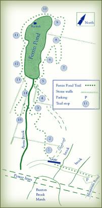
Trail FeaturesNumbers correspond to the numbers on the map. Click on the map for a printable copy of the map.
Written by Brenda Dello Russo and Jessica Smith | |
-----------------------------------
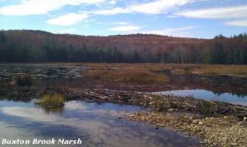 The Ferrin Pond Town Forest contains many wildlife habitats and rare natural occurences. Pictured to the right is Buxton Brook Marsh, an acidic bog that hosts beavers, perch, California Pitcher Plants, and other unique wildlife. Due to the high acidity of the water, which is rare in New Hampshire, only certain species can thrive here. Please respect the delicate nature of this wildlife habitat. This entire area is considered to be an extremely important aspect of our watershed.
The 287 acre town forest parcel is a small portion of a 2,380 Ferrin Pond unfragmented block of conserved and privately owned parcels that stretch across Deering, Francestown and Weare. *Source NRI 2012
This parcel is a town forest and is under timber management. Check the main town web site for harvesting schedules.
If you have questions concerning the Ferrin Pond Town Forest, or if you would like materials on protecting your family land, please contact the Weare Conservation Commission through the Town Office at (603) 529-7575 or email conservation@weare.nh.gov.