Felch Farm


Felch Farm

GPS Coordinates: N 43 7 24.2, W 71 42 09.22
---------------------------------

Acres: 728.6
Established: 1996

For questions on permitted uses, contact the Conservation Commission.
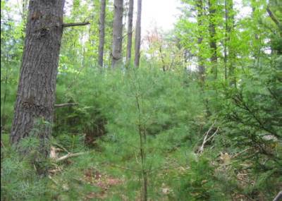
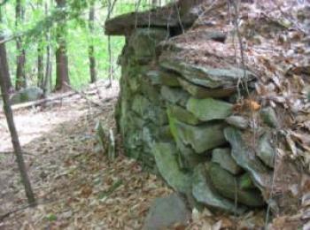
 

Felch Farm

Felch Farm Forest is a contiguous tract on 728.6 acres (620 forested)1 and is managed by the Weare Conservation Commission. The majority of the parcel is managed as a working Town Forest (693 acres) while the remaining 33 acres is managed as the Highway Dept and Transfer Station. The terrain is variable, but generally includes moderate to gentle slope. A large open wetland system, the Peaslee Meadow, runs easterly through the north of the property. Numerous trails and old roads cross this parcel, providing relatively easy access to many parts of the interior.
The forestland is varied, but is dominated by white pine established immediately following the abandonment of agricultural land earlier last century.
The property is located in the north central region of Weare, south of Route 77, west of Peaslee Road and South Road, and north of Merrill Road.
In addition to the recent multi-decade forestry stewardship, the land has a longer agricultural history; the abundance of stone walls throughout the property suggests a fairly intense use. Weare had a prosperous agricultural history, which peaked in the mid to late 1800’s. This agricultural use of the land came to a halt early last century when many farmers in New England abandoned their agrarian lifestyles and once open-land has since become reforested.
The majority of the tract acreage was at one time open agricultural land, a mix of pasture, hayfields, and croplands. The present forest is a mix of hardwoods dominated by red oak, hemlock, and large white pine approximately 90-110 years old. Pine often is the first forest type to occupy abandoned agricultural land, especially old pasture land, as the cattle or sheep typically browsed any hardwood that came into the field and left the pine alone. Abandoned crop land quite commonly was planted with either white or red pine or a mix of spruce, but natural pine succession occurred too. The resulting forest has been through a series of timber harvests since its reforestation in the early part of last century, as evidenced by old forest access roads and tree stumps of varying ages.
A stone cellar hole, and other stone framework associated with a farm can be found just north of Merrill Road, near the west boundary line. A small Felch family burial plot can also be found west of the homestead site, and nearly at the western boundary. A unique formation of stonework and a three-grave headstone mark the location of the burial site.